
Satellite Image Semantic Segmentation
Published:
Vision Transformer-Based Semantic Segmentation of Satellite Imagery with LoRA Fine-Tuning
Overview
This project performs pixel-level semantic segmentation on high-resolution satellite imagery to identify roads, vegetation, buildings, and vehicles — with applications in post-disaster road assessment and optimal route planning. It combines the global modeling capability of Vision Transformer with LoRA (Low-Rank Adaptation) for parameter-efficient fine-tuning, achieving high accuracy while significantly reducing training cost.
Dataset & Preprocessing
- Source: 4 high-resolution satellite image groups, split 4:1 for training/validation.
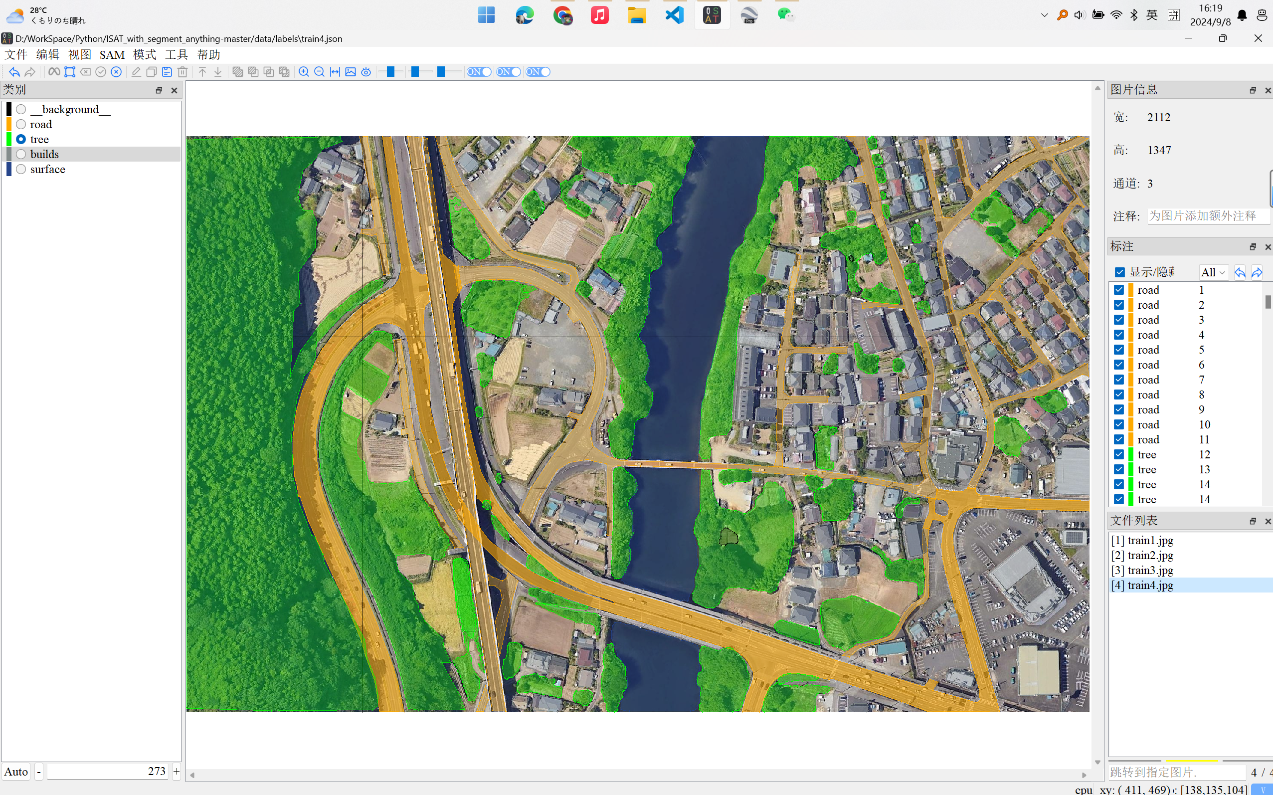
- Annotation: ISAT (Interactive Semantic Annotation Tool) + Segment Anything for efficient, high-quality labeling.
- Augmentation: Random cropping, translation, rotation, flipping, and color jittering — expanding from 4 samples to 10,000 training pairs.
- Pipeline: OpenCV-based automated loading, patch generation, and CSV indexing.
Model Architecture
Backbone: ViT-L/14 + LoRA
Pretrained ViT-L/14 as the feature extractor, with LoRA injected into the Attention Q and V layers:
\[W' = W + AB, \quad A \in \mathbb{R}^{d \times r},\ B \in \mathbb{R}^{r \times d},\ r \ll d\]This reduces trainable parameters by over 90% while preserving pretrained representations.
Decoder: MyModelSeg
A lightweight decoder on top of ViT features:
- Token-to-feature-map reshape
- Convolutional layers + upsampling + ReLU
- Restores spatial resolution for pixel-level prediction
Inference
Sliding window strategy for high-resolution images to avoid memory overflow while maintaining spatial consistency.
Training Configuration
| Parameter | Value |
|---|---|
| Optimizer | AdamW |
| Loss | Dice Loss |
| LR Schedule | LinearLR |
| Batch Size | 32 |
| GPU | RTX 4090D (24GB) |
| Iterations | 20,000 |
| Training Time | ~3 hours |
Results
Overall Accuracy: 82.65%
The model successfully segments roads, vegetation, building outlines, and vehicles. In post-disaster scenarios, it can quickly identify passable vs. blocked road sections.
Showcase
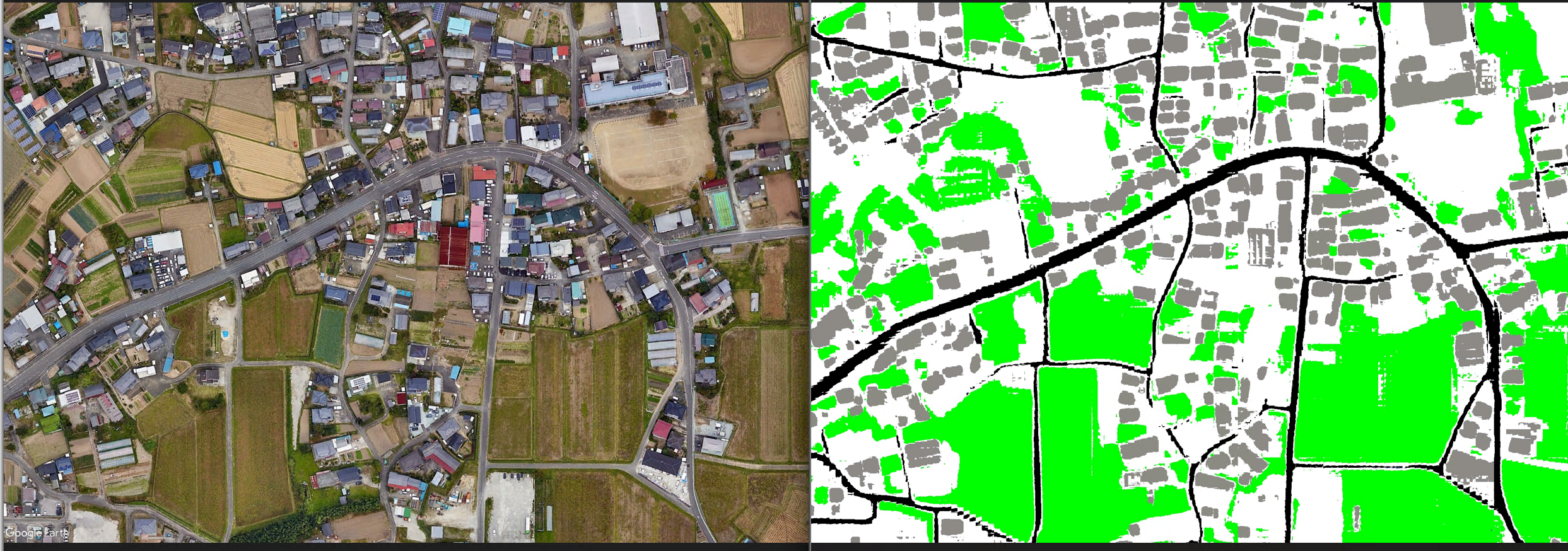
Label data used for training:
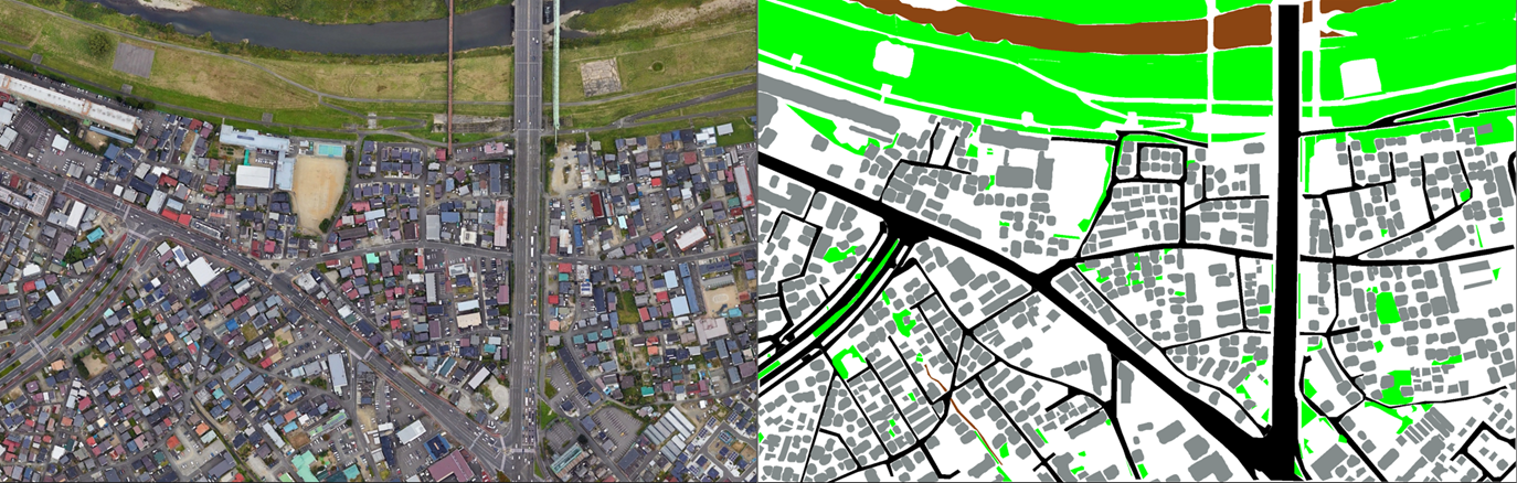
Training results:
Applications
- Post-disaster emergency route planning
- Urban traffic recovery analysis
- Disaster assessment systems
- Smart city remote sensing monitoring